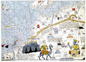
POSTCARD NORTH AFRICA MAP 14TH CENTURY CATALAN MAJORCA , vendido en Junio 2010, ¡Por 1.93 US$!
¿Cansado de perder subastas en el último segundo?
Date de alta en Keecua.com y consigue artículos como éste al mínimo precio gracias a las pujas de último segundo de Keecua.com, con Keecua.com conseguirás los mejores precios en eBay y evitarás subastas fraudulentas.
Seller assumes all responsibility for this listing.Item specificsCondition: New: A brand-new, unused, unopened, undamaged item. See the seller's listing for full details. See all condition definitions
MAP POSTCARDFourteenth-century Map ofNORTH AFRICA (detail)from Catalan Atlas (Majorca, 1375)c. ROYAL GEOGRAPHICAL SOCIETY (WITH IBG) LONDON UK ENGLANDUNUSED MODERN CHROME REPRODUCTION NON- LINEN POST CARD POSTCARD
APPROX. SIZE: 6.5" X 4.75"
ON BACK OF POSTCARD:
Fourteenth-century map of North Africa 9detail)
Catalan school
From a facsimile edition of the Catalan Atlas (Majorca, 1375); generally attributed to the Catalan school of Jewish map and chart-maters based on Majorca in the early 14th century.
c. ROYAL GEOGRAPHICAL SOCIETY (WITH IBG) LONGON
Description
UNUSED GENUINE MODERN CHROME REPRODUCTION NON- LINEN POST CARD POSTCARD
Payment and Shipping Terms SHIPPING AND HANDLING:NO RUSH TO PAY, I CAN HOLD CARDS FOR UP TO 3 WEEKS FOR A COMBINED SHIPPING RATE OF ONLY .99 FOR ALL (NO MATTER HOW MANY) CARDS PAID FOR WITH A SINGLE PAY PAL PAYMENT AND SHIPPED TOGETHERWHEN READY TO CHECK OUT, EMAIL ME FOR A COMBINED SHIPPING DISCOUNTED PAY PAL INVOICE
00014


