, vendido en Abril 2010, ¡Por 51 EUR!
¿Cansado de perder subastas en el último segundo?
Date de alta en Keecua.com y consigue artículos como éste al mínimo precio gracias a las pujas de último segundo de Keecua.com, con Keecua.com conseguirás los mejores precios en eBay y evitarás subastas fraudulentas.
Seller assumes all responsibility for this listing.Item specifics - MapsFormat: Sheet MapAntique/ Modern: AntiqueRegion: EuropeCondition: UsedMap Type: Historical/ Political, Regional/ Local
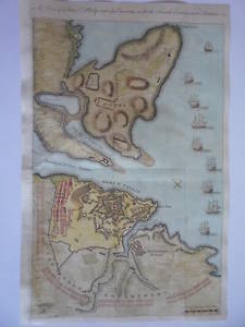
. Mediterranean, Balearic Islands,Menorca, (A Plan of Fort St. Philip and its Environs with the French Encampments, Batteries &c.),
A very lovely plainches.n complete with 9 ships under full sail. Dark, crisp impression with great detail. A very handsome plan.
Original copper-plate engraving,Published London 1756.
Plan has been remargined on left hand side, folds as usual, attractive later hand-colour.
Size, 8.5 x 12.5 inches.
00037


